Main content
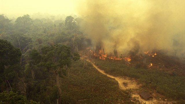
How are the Amazon's fires tracked from space?
Data from the ISS and Nasa's GEDI (pronounced Jedi) mission are helping to recreate 3D images of the Earth's surface before and after forest fires. Dr Luiz Arag茫o, head of remote sensing at Brazil's National Institute for Space Research, explains how optical and thermal satellite images are delivering real-time data about deforestation in the Amazon.
(Photo: Amazon fires. Credit: Getty Images)
Duration:
This clip is from

More clips from Digital Planet
-
![]()
Electricity from human waste—Data in disaster zones
Duration: 02:58
-
![]()
What happens when the Bitcoin miners leave?
Duration: 06:37