Using drones to spot Angola's landmines
Lasers and thermal technology are being used to map out where mines are hidden.
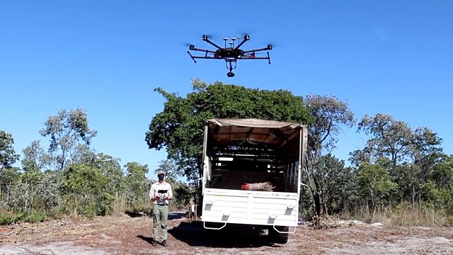
Drones equipped with lasers and thermal technology are being used in Angola to find some of the thousands of active landmines which are still scattered across the country.
Angola's government is investing heavily in removing the mines - a legacy of the civil war nearly two decades ago - in the hope it can open up and develop much of the country for tourism and other industries.
The drones will be used to map out mine lines across the country - allowing humans to manually clear the mines more quickly and safely.
The group using the technology is the charity The Halo Trust. Its head of communications, Paul McCann, says in south east Angola there are two large national parks which are almost the size of the UK, but which still can't be used because of the mines:
"The presence of 153 minefields has meant you couldn't really put in place the kind of wildlife protection measures and conservation you would in other places... They want to host elephants, they need to be protected, we need to put rangers in place and all of that requires first that the mines are gone. And then that part of Angola can be set up for conservation tourism."
(Photo: A Halo Trust worker using the drone technology. Credit: The Halo Trust)
Duration:
This clip is from

More clips from Newsday
-
![]()
'I immediately called my mother, I told her that I was alive'
Duration: 02:21
-
![]()
'People on both sides have suffered enough'
Duration: 04:44